Showing posts with label USA. Show all posts

Friday, January 2, 2015

One Year plus 0.242190 Days

Moore's Memorial Park, Ames, IA (January 10, 2014)

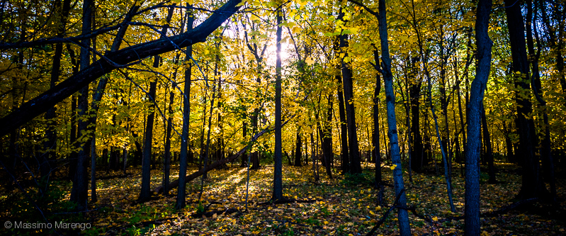
New year, new post, the first update of this blog since the last summer. The fall has come and gone: a cold November spell, with the only snow we got so far in this season, and an unusually warm December with autumnal weather through the solstice into the new year. The photo above? A snowfall from last year. This year's weather looks more like the small iphone photo below on the left.

January 1st, 2015
It is customary at the beginning of a new year to look back at the 364.242190 spins that the planet did in its last revolution around the Sun. I will refrain from that... you are welcome to go to +Massimo Marengo and read all my rants about the never ending (but very much enjoyed) new course I had to teach this semester (in summary: lots of work to prepare new classes, and not much sleep to recover between one lecture and the next), discovering how I live in the only populated place on earth that is seemingly cooling as a consequence of climate change, the continuing disappointment of a society that for each step forward in equality seems to make three step backwards in racial and economic inequality. Let's talk instead about the calendar itself, and the consequence of these 0.242190 extra days at the end of each year. 

Wishful thinking
Unless you live on a celestial body that is locked in some period resonance with some larger mass (e.g. the moon always shows the same face to Earth, hence the duration of its day is the same as the length of a month; Mercury rotates three times every two of its years), the length of the day and the length of the year are totally random. So it happens that if you want to have a calendar with an exact number of days for each year you are pretty much out of luck, because the seasons would drift by one day every fourth year, and you would soon be celebrating harvest in the middle of spring. That was the situation in antiquity, at the time Julius Cesar went to Egypt to biblically meet the queen Cleopatra. Egypt at the time was the cultural center of the Mediterranean, thanks to the famous library in Alexandria where the summa of all knowledge was kept. It was in Alexandria that Cesar consulted with the local astronomer Sosigenes, and figured out the need to add one extra day every four years to take into account the extra time that kept accumulating at the end of each year. This is how the leap years were born.

More like it
The celestial spheres, however, are indifferent to the desires of humankind, and 0.25 (one day every four year) is not the same as 0.242190. The seasons kept shifting, albeit more slowly and in the opposite way, even after the Julian calendar correction. So was the situation in the middle ages, when the calendar was again out of sync by 10 days. This was not good for the Church, since it completely messed up the complicated calculations that were used to determine the calendar date of Easter. As a result, Pope Gregorius XIII decreed that the day following October 4, 1582 was to be October 15, 1582, obliterating from existence 10 full days from the history of the world, and removing one leap year every century (but not if the century was divisible by 400). With these changes the calendar was forced to sync again with the seasons, with an accuracy better than 0.002%. Not all countries, however, adopted the Gregorian calendar right away: not everybody was very keen to follow the dictates of a Catholic pope. The orthodox Russia, for example, didn't fix their calendar until 1918: as a result, the October bolshevik revolution actually happened in November!

Moore's Memorial Park, Ames, IA (January 10, 2014)


Saturday, June 28, 2014

Quantum Yoga

Cambridge, MA (June 18, 2005)

The main thing with Cambridge, Massachusetts, is its diversity. The big universities are the focus of a vibrant multi-ethnic community, with Harvard Square and Central Square its centers of gravity. The two squares are a joy to visit, as they host many small bookstores (revolution books yay!) and restaurants, still somehow able to survive despite the gentrification that followed the housing bubble. Among our favorite places in Harvard Square, however, there is a very special yoga studio

The studio is special because of its owner, Jesse. We started frequenting him when the studio was at its infancy, in a small basement room in Harvard Square just big enough for a few mats along one wall (I once managed to actually dent the wall, which tells a lot about my "flexibility"). Now the studio has grown a lot, opened a second downtown location, a "donation" studio (you pay what you can) a no-kill animal shelter, and much more. But Jesse is still the same Jesse, and we were lucky of being able to meet him for a chat during our last Boston visit. And as usual with Jesse, we talked about science and the nature of reality as described by physics (Jesse is more up to date about science news than me).

Riverfest in Cambridge
All this came back to my mind a couple of days ago as I read a few articles celebrating the 50 years since the publication of the Bell's Theorem, that more than any other results in modern physics is at the base of our attempts to understand reality. The theorem applies to quantum mechanics, the foundational theory of modern physics. Developed at the beginning of the XX century, quantum mechanics describes the behaviour of subatomic particles and forces. It replaces the determinisms of classical mechanics (where everything is predictable with clockwork precision) with a probabilistic approach. With quantum mechanics you cannot foretell where a particle will be at a given time, only estimate the probability that it will be there, or at any other location. This view, which is based on the work of Niels Bohr and the "Copenhagen" school, has been found to be inherently unsatisfactory to many scientists, including Albert Einstein when he proclaimed that "God doesn't play dice with the world". The favorite loophole invoked by the critics was to assume that quantum mechanics was an incomplete theory, e.g. that there was some missing equation with hidden variables that, if measured, would predict the exact outcome of any physics experiment. Bell's theorem closed this loophole, by showing that any physical theory (including quantum mechanics) cannot have hidden local variables. As a consequence, the world is either inherently random (and the exact result of any experiment is unknowable until somebody measures its outcome), or physics is non-local.

Losing locality, however, is as bad for common sense as much as believing in a random universe. If physics is non-local then anything anywhere in the universe can in principle affect, instantaneously, the outcome of a physics experiment. This contradiction was famously popularized by Einstein, again, when he suggested that the loss of locality would lead to a "spooky action at a distance", where entangled particles would have the mysterious ability to determine each other status instantaneously as if they could communicate "telepathically". While this paradox was proposed to show the absurdity of a non-local universe, reality is full of surprises, and quantum entanglement (as this spooky action at a distance is called) was indeed confirmed in several experiment starting from 1972. The story of how these experiments is interesting in itself, and beautifully narrated in the book "How The Hippies Saved Physics". This the story of a band of physicists coming from the counterculture of the fabulous sixties set out to understand the deeper meaning of physics in between acid trips and paranormal experiments. While they did not prove the existence of telepathy and the new age idea of the oneness of the universe, they did demonstrate the reality of quantum entanglement, inventing in the process the field of quantum encryption and quantum computing.

While quantum entanglement seems to suggest that physics is indeed not local, superluminal communication is still prohibited by Einstein special relativity. The true meaning of this spooky action at a distance, as a consequence, is quite obscure. Living in a fundamentally unpredictable universe is however also very unsatisfactory, despite the sci-fi appeal of multi world theories where all possible quantum solutions do happens at the same time, just in different "parallel" universes. A century after being discovered, we casually use quantum mechanics without even noticing, every time we turn on the switch of any electronic devices whose semiconductor technology is based on the weird nature of quantum mechanics. Yet, like children playing with magic toys from alien civilizations, we are still far from understanding the deep principles upon which our gadgets are based and, fifty years after the publication of Bell's theorem, the true nature of our quantum universe.

Boston seen from Cambridge, MA (June 18, 2005)

Sunday, June 22, 2014

Two Schools in Newe Towne

Weeks Footbridge, Cambridge, MA (June 18, 2005)

When I say that I lived in Boston for 12 years, I really mean Cambridge, MA. Cambridge, on the other side of the Charles river, is the left-wing, intellectual counterpart to the financial centers / 1 percenter character of downtown Boston. Hosting both Harvard and MIT, even its name is a tribute to its ivory-tower destiny. When in 1636 the legislature of Massachusetts Bay Colony voted to form a College for training its Puritan ministers, the school that would later become Harvard University was established in the village of Newe Towne. In less than two years, as the College was becoming more and more successful, the name of the village was changed to Cambridge, in honour to the renowned England university. That sealed the fate for the little village across the Charles river, destined to become a beacon of culture and power that century later would rival its namesake across the pond.

Fountain across the Harvard Yard, in Cambridge
The center of Cambridge is Harvard Square, the original location of Newe Towne, and the current site of the Harvard Yard. That's where you find the red-brick-ivy-covered buildings one typically associates to an ivy-league University. They are still there, the old dorms where the freshmen stay when they arrive to the College, to be inoculated with the germs that will make them true-crimson pureblood harvardians for the rest of their life. Even today, Harvard is the university most associated with the US ruling class, a class of lawyers and graduates from its famous school of Government dedicated to John F. Kennedy, J.F.K. Despite being established by the legislature of the Colony, Harvard is now a private University. A huge one, with an endowment so large (over 30 billion dollars) that if it wants, Harvard could offer free education to all its students.

Then there is the MIT. Closer to the river, the Massachusetts Institute of Technology was established two days before the start of the civil war when the country realized that the development of science and technology was essential for its future (oh, how would you wish this is still true). It was modeled after the tradition of the european polytechnic schools. It is now one of the most selective universities in the world, with less than 8% acceptance rate. Many of the technological inventions that define our age have originated in halls of the MIT, whose symbol is the large dome visible across the river in the photo at the bottom. Strangely enough, the main rivalry of MIT students is not with Harvard, but rather with the California Institute of Technology, the Caltech in Pasadena, California. The story of the pranks between the two schools is legendary, and includes a real spanish cannon stolen from the Caltech campus and transported cross country to the MIT. This is just one of the many hacks for which the MIT students are famous.

The MIT dome, Cambridge, MA (September 6, 2008)

Wednesday, June 18, 2014

Like in the Movies

Boston, MA (September 6, 2008)

The first time I landed in the US was at the end of October. I came to visit Mayli, just a few months after she had moved to this country for graduate school, in one of the many Universities of Boston. At the time she was living in a small apartment in Somerville, one stop before the end of the red line.

Old State House
I still remember Mayli's letter describing her first landing at the Boston Logan International airport. How the city seemed impossibly large, extending in all directions not occupied by the ocean. But while she first landed in August, my first landing was in the fall: it was already after sunset and all I could perceive from my seat was the dark expanse of the Boston Bay and the sudden noise of the plane wheels hitting the tarmac. My first landing was not very scenic. Immigration: check (Italians at the time could get in the US for three months with just a passport stamp on entry; now they need to get a visa in advance). Custom: check (what could I possibly have to declare, in my rigid-frame suitcase with three weeks of underwear change?). Butterflies in the stomach (the anticipation of seeing Mayli). Actually finding her on the other side of terminal E's sliding doors. The taxi ride through the Sumner tunnel (for many years I thought is was dedicated to a season), negotiating the pre-Big Dig traffic all the way to Somerville. The small annex apartment in Clyde St. (tiny, but hey, not many graduate students were lucky enough to rent their own apartment).

That's how it began. 

Somerville didn't conform to my idea of the USA. My knowledge of american middle class neighborhoods came from the Milwaukee of Happy Days, but somehow I was expecting either the New York city of Annie Hall, or the desolation of the Bronx in a old Paul Newman cop movie. At least I knew I wasn't visiting the Old West, so I wasn't expecting horses and crazy tumbleweed bushes roaming in the desert. Somerville seemed a safe neighborhood, with its old and slightly run-down New England-style cardboard houses (I discovered that they were made of cardboard the first time I sat on the futon, when leaning back I heard the deaf sound of the wall as I hit it with my knuckles): it was no Bronx here. But the half-rusted cars parked along the cheap chain link fences, and the open-air tangle of wires hanging from the street wooden poles, not one of them standing straight, didn't have the glamour of Manhattan either. Reality was a little more prosaic than the Hollywood fiction. Yet all was so alien to me that even the chocolate chip cookies with earl grey tea in the humid and cold mornings tasted like the new world.

It rained a lot. Between the unpleasant rain and my exceedingly bad english I didn't dare to get out much alone the first days. When Mayli was busy, I spent most of my first week studying in the Tufts library, and watching the cat-sized squirrels in the extraordinarily green lawn across the library windows. Then the weekend finally came, and with it my real introduction to Boston. We took the T from Porter to Park Street, and from there we followed the freedom trail. I don't have photos taken in that expedition, but I remember it like the small image above on the left: wet pavement in front of tall modern buildings, and the occasional old-brick piece of history embedded in the glamour of a modern US city. We walked the full day, me still trying to reconcile the reality I was seeing with the idealized world remembered from TV. Then sunset arrived, with it the night's shadows enshrouding the urban landscape, now lit by the streetlamps and the car's headlights. That's when I saw it.

The steam rising from the manholes in the street. Like in the movies: at last, I found my America. 

Boston, MA (September 6, 2008)

Sunday, June 15, 2014

A Trip to Boston

Boston, MA (June 7, 2014)

The Summer Meeting of the American Astronomical Society, this year, was in Boston, Massachusetts. This was the perfect opportunity for me to return to the city where I lived for 12 years, before moving all the way to the middle of the country. The meeting was at the Westin Hotel in Copley, which is close to the Hancock tower, the tall blue building in photo above, right at the center of the city.

Sara Seager in Plenary
Summer AAS meetings tend to be smaller than the January meetings, yet there were almost 1,200 astronomers in town. The format of the meeting is the usual for the AAS: a number of plenary sessions spread through the day with parallel sessions in-between, where shorter talks were grouped thematically and delivered in smaller rooms. Two of my students were giving talks in the parallel sessions: one about his search of brown dwarf companions hiding in the periphery of extrasolar planetary systems, and the other about measuring the efficiency of star formation across the Galaxy. While the parallel session talks are delivered as brief "science" updates and tend to be very technical, the plenary talks are intended for a general astronomy audience, and tend to provide a broad overview of the field for non specialists. They are fun to attend. The picture on the left shows Sara Seager, extrasolar planets superstar from MIT, talking about the characterization of planetary systems found by the Kepler telescope, and the perspectives offered by future missions. Very timely, as the continuation of Kepler itself (the K2 mission) has just been approved by NASA (albeit at the expenses of other, equally useful, space telescopes). K2 is a cool hack: Kepler was designed to work with three reactions wheels, gyroscope-like devices that allow the precise pointing necessary to achieve its legendary photometric accuracy. Down to two wheels after malfunctions, Kepler was due to be retired until clever engineers figured that they could use the solar radiation with the remaining reaction wheels as a stabilizing force, the same way a sailboat use head-wind to coast against the current. Devilishly smart: it is rocket science after all. The K2 mission will operate differently than before, and its focus will be more on the stars hosting planets, rather than finding more planets like Earth: this is however as important as the search for extrasolar planetary systems, as pointed out by my Iowa State colleague Steve Kawaler in his excellent and entertaining plenary talk.

The meeting finished on Thursday, so I spent the last day of the week visiting the Harvard-Smithsonian Center for Astrophysics (CfA), which was my workplace for the 12 years I lived in Boston. It was nice to see everybody, including the part of my group that is in California (also in Boston for the meeting), and one of my graduate students there with a fellowship to finish her thesis. As a plus, I discovered that some of my CfA friends, including my old boss, had been converted into manga characters, as a part of a collaboration between US institutions and the Tohoku University in Sendai. How cool is that?

Fenway Park
I will talk more, in future posts, about the plenary talks at the AAS and my CfA visit. Let me finish this long overdue entry with a comment about the photos. As you have certainly noticed these are cameraphone photos, shot with my iPhone 5s, and processed in-phone with Snapseed. I didn't bring my "real" camera (the Nikon 700) with me, as I often do in trips that are mainly work. This trip was actually borderline, as I stayed in town for the weekend after the meeting, and went around shooting along the Charles river (top and bottom photo) and in the neighborhood of the hotel (which was just behind Fenway Park, the famed and sacred home field of the Boston Red Sox, photo on the right). But I have already amassed a quite large selection of Boston quality photos in the years I have lived there, so it was fun just walking around happily snapping snapshots with a phone, layering artsy textures in accordance to the mood I felt while I was pressing the shutter. After 5 years in the corn fields, one forgets the diversity of life in the large human conglomerates of the East coast cities. I have been frequently to Chicago, but it is different. One ends up living in the suburbs, and the suburbs of Chicago are not different than the suburbs of a midwestern university town. Boston (and Cambridge where I worked), had a unique pulse, which is difficult to replicate in the middle of the country. Or maybe I am just getting nostalgic?

Boston, MA (June 7, 2014)

Thursday, December 12, 2013

The domain of Kamapua'a

Big Island, Hawaii (November 7, 2005)

As dry is the southern part of Hawaii Big Island, wet and lush is its northern end. Sitting on the most ancient of the island's volcanoes, the domain of Kamapua'a is battered by the trade winds, harbingers of rain. It is a stark contrast with the desert black rock wasteland of the Volcanoes Park. 

Pololu Valley
One of the most picturesque spots of the green north is the Pololu valley. To reach it you have to drive around the north tip of the island, either along the trafficked coastal road (Maukona-Niulii Rd), or along the Kohala Mountain Rd. We chose the latter: the road starts from Waimea (allowing a brief visit to the Keck Observatory Headquarters) and climbs on the flanks of the Kohala mountain. Estimated to be 1,000,000 years old, it is now extinct, having last erupted more than 160,000 years ago. It is highly eroded, covered by green pastures on the western side and deep valleys on the eastern side. Driving along the mountain road one can be excused to think, for a moment, that this is not Hawaii but Ireland (see panoramic photo below). The landscape is dotted by cows and horses: cattle raising is the main industry of this area, spawning the tradition of the Hawaiian cowboy equivalents.

The road ends in Hawi, a small town of less than 1,000 people, significant because its territory includes the birthplace of Kamehameha I the great. From Hawi you should follow route 270, literally to the end of the road. You park the car, walk to the side of the road and, lo and behold, you see the view in the large photo above (well, I cannot guarantee that you will still see the same horses next time you go there). The huge cliffs are the result of hundreds of millennia of erosions by the ocean and the rain on the tired igneous rocks of Kohala. Hidden between the cliffs is the long narrow Pololu valley, which you can see in the small photo on the left. From the parking lot at the Pololu lookout you can walk down (on a 400 ft steep sandy trail) to the bottom of the valley. The valley is all private land, so there is not much you can do there unless you ask permission to walk the swampy trails that cross it through its length. The beach at the end of the valley, however, is quite a spectacle, thanks to its black sand and high surf typical of Hawaii eastern coast. It is a popular destinations, provided of course that you are willing to climb up all 400 ft of trail to get back to the car, on your way back home.

Big Island, Hawaii (November 7, 2005)

Tuesday, December 10, 2013

The volcano that never stops

Double rainbow on Kilauea, Hawaii (November 3, 2005)

Kilauea, Hawaii
The Hawaiian islands were born by the union of the Sky Father Wakea with the Earth Mother Papa. As such they are the abode of the gods of hawaiian mythology. Two of these gods, however, never got along very well. Pele, the goddess of fire, and Kamapua'a, the god of rain, kept fighting memorable battles all the time. The theatre of the most epic of these battle is the crater of Halema'uma'u, where Pele found refuge when the rain god tried to extinguish the lava that she made sprout from the ground. To force her to out, Kamapua'a covered the crater with fern fronds, trapping of the smoke and choking Pele in her hiding place. Mad for the affront, Pele threatened to destroy the whole island. At that point the other gods were forced to intervene, dividing the island among the quarreling deities. Kamapua'a got the northern side of the island, rich in moisture carried by the trade winds. Pele was confined to the south-eastern side, the dry domain of the volcanoes.

The domain of Pele is dominated by one of the most active volcanoes on Earth: the Kilaueua. This volcano has been continuously activity for most of the islands recorded history. Even before, Hawaiian oral histories testify about Kilauea random acts of violence, like the eruption of 1790, when the present-day caldera was formed, as the ground collapsed under the feet of Keouha Kuahu'ula warriors, the last to resist the unifying forces of Kamehameha I, the great. Since then Kilauea has had at least 61 recorded eruptions.

Kilauea, Hawaii
The volcano is part of the Hawaii Volcanoes National Park, and is one of the most monitored volcanoes on Earth. In fact, it was the first volcano to be monitored, by initiative of Thomas Jaggar. The MIT geologist, after witnessing the destruction caused by the earthquake in Messina (near Mount Etna) decided that a network of observatories monitoring the activity of volcanoes was absolutely required. He chose Kilauea because of its high activity and the relative benign nature of its eruptions. The fact that the eruptions are benign does not mean that they are not impressive, though. In 1819 a huge lava flow filled the caldera in the photo above, creating an enormous lava lake. In other occasions the activity was so strong that reportedly allowed the inhabitants of Hilo (20 miles away) to read at night without the need of other lights!

The Volcanoes Park and Kilauea today are a big touristic attraction. If you go there at sunset you can see the lava flow dropping in the sea (panoramic below). From the parking lot it is a short hike on a pitch-black moonscape terrain until the rope that delimit the "safe" area from the places where the fresh lava is still warm. The park ranger discourage you from hiking beyond the ropes, but people still do... which leads to the inevitable casualties, mainly tourists that walk too close to the volcanic vents, their lungs swelled by the deadly inhalation of hydrochloric acid. That said, if you are careful, Kilauea is one of the most spectacular places in the world to visit!

Kilauea, Hawaii (November 3, 2005)

Saturday, December 7, 2013

The tallest mountains in the world

Mauna Loa, Hawaii (November 3, 2005)

Mount Everest is not the tallest mountain in the world. Not by far. It sits on the Himalayan plateau, which is pretty high itself. With 8,848 meters above sea level, mount Everest is the highest mountain in the world, but not the tallest if you start counting from its base. That record is held by the Hawaii volcanoes, Mauna Kea rising 10,203 meters from the seafloor, followed closely my Mauna Loa, a few meters lower but the largest mountain in area and volume of rock.

Mauna Loa, Hawaii
And in Hawaii we should go, because I cannot make a series on mountains and forget the mountains of paradise. Hawaii has special significance for an astronomer, because it is the site of the largest telescopes in the norther hemisphere. For obvious reasons: why would you go anywhere else if you can get a free trip to Hawaii? Just kidding. The real reason for placing gigantic mirrors on the top of the Hawaii volcanoes is precisely their height: the highest the mountain, the less air is overhead, ruining your observations. Why not going to the Himalayas, then? Because of humidity. It turns out that the Himalayan chain is still subjected to heavy precipitations from the monsoons raising from the Indian Ocean (these are snow-capped mountains), while the volcanoes of Hawaii are above the local inversion layer. Even though in Hawaii it rains every day, the humidity stays at lower elevation, and the summit of the volcanoes is bone dry. No humidity means no rain days and, most importantly, a very transparent and stable atmosphere. The only other comparable sites on Earth for elevation and dryness are the high plateau of northern Chile (we will go there, photographically, a little later) and Antarctica, which is covered by 3,000 meters of ice (and has very low humidity, as all water vapor is frozen).

I have been several time at the Mauna Kea observatory: I did a large part of the astronomical observations for my Ph.D. thesis up there. At that time, however, I didn't have any digital camera (hey, that was still in the last millennium), so the photos in this post are more recent, taken when I was visiting Hawaii for a conference. All images show Mauna Loa, the volcano whose eruptions created most of the land in the Big Island of Hawaii. It is a shield volcano, and as such it has the gentle sloping flanks that can be seen in the large image on top. Gentle volcano is not, however. Since the first recorded eruption in 1843, the volcano has erupted 32 times. The 1935 eruption, in particular, caused grave concern as the lava flow started to move towards Hilo, the main city on the island, George S. Patton (of WWII fame) was tasked to save the city by trying to divert the lava flow by throwing bombs at it: he did so on December 27 of that year, and by January 2 the lava flow was stopped. While the operation was declared a resounding success, it is unclear if the bombing had any effect, and geologists think that the lava stopped only because the volcano decided so.

The last eruption happened in 1950, with a single day event in 1984, when a narrow lava flow descended again towards Hilo, illuminating the city at night but stopping before causing any damage. Since then the volcano has been inactive, the longest period of quiescence in its recorded history.

Mauna Loa, Hawaii (November 7, 2005)

Friday, December 6, 2013

Mount St. Helens

Mount St. Helens, USA (January 11, 2007)

There was a mountain in North America that was as beautiful as Fuji-san in Japan. It was a perfect cone with a snow-white tip, raising to the sky amid lush forests and crowned by silvery rivers. That mountain was sacred to the people living in its vicinity.

Washington State, USA
Wikipedia tells us that Tyhee Saghalie, the chief of all the gods of the Klickitat people, traveled down the Columbia river from the ancestral lands in the north. He was with his two sons, Pahto and Wy'east, searching for a new land to settle. After much wandering they found a land so beautiful that both brothers wanted it for themselves. To resolve the dispute, their father used his magic bow to shoot two arrows in opposite directions. Patho followed the arrow that went north; Wy'east went instead south. Their father then built the Bridge of the Gods to connect the two lands, so that they could periodically have their family reunions.

For some time everything was well and dandy, until a fateful day the two brothers met a beautiful maiden whose name was Loowit. They both fell in love and started quarreling again, while Loowit could not choose between the two of them. In their fight, they buried villages and razed forests, shaking the earth so violently that the bridge of the God fell into the river (creating the Columbia River Gorge). Saghalie was very upset by all this devastation, and decided to punish the quarreling lovers. He struck down his two sons and transformed them into mountains: Patho became what is known now as Mount Adams while Wy'east became Mount Hood. And Loowit? She became the fairest mountain of all, Louwala-Clough (fire mountain) which we now call Mount St. Helens.

I have seen Mount St. Helens once, even though I didn't know it at the time. I only recognized the mountain of fire much later, when I finally started to work on the photos I took from a plane that was bringing me home from Seattle. It is the photo above, where you can see the huge crater of the volcano, and the plume of steam still rising from it. What you cannot see is the picture-perfect cone that, like Fuji-san, stands high above the forests and the river covered in snow.

The reason why the beautiful cone is missing is that Mount St. Helens top, at the 8:32AM PDT of May 18, 1980, blew up, in the course of the most destructive volcanic event recorded in the United States. The eruption cut 400 meters from the height of the mountain, killing 57 people, flattening 250 homes, felling 47 bridges, and destroying 15 miles of railways and 185 miles of highways. It became one of the most famous volcanic eruptions in the history of North America. You can still see, even in my foto, the huge scar left behind by the explosion. The north side of the mountain is missing, crushed by the explosion into an enormous avalanche of almost 3 km cube of debris. When President Jimmy Carter visited the devastation shortly after the eruption, he commented that "Someone said this area looked like a moonscape. But the moon looks more like a golf course compared to what's up there."

The area around the mountain was designated in 1982 by President Reagan and the US Congress (when it was still doing something) as a national Monument. As such it is granted protection that has allowed scientists to study how the environment can naturally recover from the disturbance caused by such cataclysmic events.

Taking off from Seattle Tacoma, USA (January 11, 2007)

Friday, November 1, 2013

River Valley Park

South Skunk River, Ames, Iowa (October 26, 2013)


As I have mentioned before, I live close to Squaw creek, which is a third order tributary of the Mississippi. As rivers go, Squaw creek is quite short (42 mi), so short in fact to be fully contained in just three counties. The Squaw creek never gets out of Ames, as it flows into the South Skunk river just a few miles south-east of my house. The South Skunk river is the subject of the photo above.

The Squaw creek and the South Skunk river are the reasons that Ames is criss-crossed with so many green areas. Despite their diminutive sizes, the two rivers are prone to flooding. As a result large areas within the borders of the town cannot be developed, and are reserved for public parks. The River Valley park, in particular, follows a good tract of the South Skunk river as it crosses Ames. With 4 miles of trails, it is one of my favorite places to walk with Kero. The paths follow the river for the whole length of the park, inside a thick canopy of a deciduous forest that looks stunning this time of the year. On the way back the trail border open fields, typically used for either soy or corn (hey, we are in Iowa, the alternative would be pig farms).

In winter the trails are groomed for cross country skiing, which precludes our access to the park during the skiing season. The problem with groomed trails is that Kero doesn't use skis, so if we were to go there we would be stomping on the trails ruining them for the other skiers. For this reason we go to different trails closer to my house, which nobody grooms but that I can still navigate with my larger-than-average cross country skis (pulled by my personal four-legged ski-lift). But there are hopefully several more weeks before we will get to snow time. In the meantime it is good to enjoy the colors and the haze of autumn.

River Valley Park, Ames, Iowa (October 26, 2013)


Tuesday, October 29, 2013

1000 Miles

Ames, Iowa (October 27, 2013)


Gravity
+Rurousha  linked this article about the irish naturalist Robert Lloyd Praeger, and his habit of random walking as a method to study the flora of Ireland. Walking is my favorite activity and an integral part of my photography. The description of Praeger attentive walks, where the focus is not on the destination, but on the walk itself, resembles the way I walk when I am in the "zone". My goal may be the scenic viewpoint at the end of the path, but most often than not the view waiting to be found is in the anonymous bend in the road. I never know in advance where my next photo is waiting for me. If I had not walked focused on the path, rather than the path's end, I would have missed it.

Fortunately for me, Kero also likes (demands) long everyday walks, one to two hours every day, no matter the weather or the temperature. He does slow down in Summer, as Samoyeds really don't like hot weather, but makes it up as soon as the thermometer turns downward. So we don't quite average the 1,000 miles per year recommended by the article, but we get quite close to that number. And even if we tend to go mostly in the same places (Ames is not that big) every day is different. The weather changes, the light transforms, life makes sure that every day there is something new to discover and bring back home.

Sunday, October 27, 2013

Instagram

East River Valley, Ames, IA (October 26, 2013)

During the last month I have been posting assiduously on Instagram. As you are most likely aware, Instagram is a cameraphone-centric photo hosting free site. I wrote cameraphone-centric because by far the preferred way to access and interact with the site is via their smartphone app, both for viewing and for submitting photos. Since I started using more regularly the camera on my iPhone 5s, I found myself posting photos more and more frequently on Instagram. And the experience has been quite liberating.

Let me explain. I am very careful and disciplined with my photography. I try to think ahead and shoot in a format meant for long term preservation of my images. I always shoot raw (the equivalent of digital negatives), which gives me the maximum possible dynamic range (the number of "stops" saved in the digital file) and later freedom in editing the image. I use a raw-file capable image processing software (Lightroom) that preserves intact the original data, applying reversible edits to correct for brightness, contrast, color balance and composition (crops). I strive to only do the minimal editing, not because I have something against photo manipulations, but because each step invariably degrade a little the quality of the final image. In practice I try to do to my images nothing more and nothing less than a good wet darkroom photographer would have done to transfer his or her negatives to paper.

Instagram is the opposite of all this. Cameraphones generally save their images in JPG format, which uses lossy compression algorithms (each time you save a JPG file you lose details). The Instagram smartphone app allows you to apply heavy handed "filters" and "frames" meant to reproduce the look and feel of old polaroid and toy cameras. The app by default scales the image, cropped to a square format, to 640x640 pixels. This low resolution guarantees that you will never be able to print it on paper, unless you want to restrict yourself to very small print sizes (scale it up to even the traditional size of polaroid photographs, and you will see pixels). Given all this, why did I say that my experience with Instagram has been liberating? Well, there are two main reasons. Instagrams are limited in the same way that a real-world polaroid camera (or a toy camera such as Holgas) are limited, in the fidelity in which they can reproduce the scenes they capture. Still their peculiar look-and-feel has spawned communities of photographers choosing to use those cameras as a way to express their creativity. The limitation of the medium is not a limitation in creativity, just a challenge more. The rough Instagram filters are without doubt a shortcut to more rigorous digital darkroom techniques, and a sure way to degrade the technical quality of the images, but who cares? The artistic value of an image is not necessarily equivalent to its technical perfection. Instagram is liberating because it gives you less options: with the camera working in automatic and very limited editing possibilities, you only have to think about subject and composition, which is in the end what matters.

There is however also a second reason. A common saying among photographers is that "the best camera for the job is the one that's with you": I only have my Nikon D700 camera and lenses with me when I go out purposely to take pictures. I don't carry it unless I have some expectation of spending some time dedicated to photography: I don't bring it with me every day in my walks, and often I don't even carry it in my backpack when I am going on a work trip where I expect to spend most of my waking time in meetings or working in my hotel room. My phone, however, is always with me, and it takes 10 seconds to pull it out of my pocket and shoot. And with pervasive wireless internet, less than a minute later the final Instagram is available, for the whole world to admire, on the internet.


--- Last considerations ---

I shot the small photo on the left from the same vantage point of the large photo above. The large photo was taken with my D700 camera and 24mm wide lens, and edited in Lightroom. The small photo is an Instagram taken using one of the standard Instagram filters and enhanced contrast adjustments, and no further editing. At full resolution, the details of the Instagram are clearly inferior than the D700 photo, and it won't print as well. Still the Instagram is perfectly fine for the web, and much more immediate than a D700 picture.

The Instagram image resolution issue is actually easily solved. Shoot your image with the native cameraphone app (modern cameraphone CCDs have now a pixel count comparable to semi-professional digital SLR cameras, even though the smaller sensors will generally be much noisier), and import it in Instagram later. This will save a local copy on your phone with full resolution, even though the photo transferred on the site is probably still 640x640 pixels in size. The only part of the Instagram processing that doesn't scale up to full resolution is the frame border: you will get a blurred version of a 640x640 pixmap of the border, which you will have to crop out if you want to print your Instagram.

You can see my Instagrams at: http://instagram.com/oornitorinko

Ames, Iowa (October 26, 2013)


Thursday, October 24, 2013

Duotone

Ames, Iowa (October 19, 2013)

This is not really a duotone, just a background that is half sky and half dry autumnal grass bokeh. The flower (I don't know its name) blossoms late in the Summer, and then produces this fluffy white "fur" made to disperse its seeds in the strong Iowan winter months. It is purple when blossoming, but I almost like it more in the fall, so dignified with its silver crown of hairs.

Wednesday, October 23, 2013

November Weather

Ames, Iowa (October 19, 2013)

Weather finally catched-up with us: it was snowing this morning in Iowa. Not the January snow, the one that sticks hard to the ground and you can walk on it as if it is white marble. More like the November one, the slushy snow that becomes rain as soon as it touches a surface. Any surface, be the grass, or my hand. Or the snout of a dog too eager to go out for his morning walk, oblivious of the miserable weather. Loudly dragging me outside, when I would just have stayed tucked-in for the rest of the day.

The yellow daisies in the park have long lost their petals. Their dark heads are still standing up, proud, on their thin dry stalks. They will soon wear fashionable sparkling hats. How long until autumn's golds will turn into winter's whites? 

Ames, Iowa (October 19, 2013)


Thursday, August 22, 2013

Hotel Connoisseur

Chicago, IL (July 4, 2013)

The dog in the photo is Kero, short for Kerokai. He is our four legged family member and is a Samoyed. Samoyeds are a northern dog breed, akin to Malamutes and Huskies. It is one of the most ancient dog breeds, originally bred by the Samoyedic people (northern Siberia). The Samoyedic people are nomadic and their dogs were (still are) used to help herding their reindeers, pull their sledges and keep an eye on their kids. Differently than other sledge dogs, Samoyeds were allowed to stay at night inside the tent, to warm their occupants in the long arctic nights (Sammys have a very thick and warm double coat, that can be actually used as wool in knitting). Because of this origins, Sammys are perfect family dogs: they adore kids (and actually sometimes try to herd them, just for the fun) and want to be involved in every aspect of family life. Sammys are also very funny and have a keen sense of humor. I don't think they really mean to be humorous, it is just that they have a lot of behaviors and antics that are very human-like and uncannily funny (and sometimes a little exasperating). They are certainly high maintenance dogs, mainly because they pretend almost constant attention (never let a samoyed get bored).

The photo above proves the point. We travel a lot and when possible (i.e. when it is a road trip) Kero travels with us. Traveling with a 50 pounds dog requires some planning, because most hotels don't accept dogs. The problem is that Kero doesn't just want any hotel, he has his preferred brands, and the one pictured above is his favorite hotel, the Warrenville Hyatt House (yes he has expensive tastes, ouch)! I have no idea why, but that Hyatt is the only hotel he likes in the whole Chicago area, and if we use another one he complains quite loudly (Samoyeds howls like wolves), which is something you don't generally want your dog to do in a hotel. Fortunately, since Mayli is affiliated with Fermilab, she has a preferred rate with the Hyatt, which is what saves us from going bankrupted because of the lodging pretensions of our dog. Oh well...