Showing posts with label New Zealand. Show all posts

Thursday, August 4, 2016

Leaving New Zealand

Auckland, New Zealand (Jun 7, 2008)

The trip finally arrived to its end. The last day our friends accompanied us to the Auckland Museum, where we saw the Maori exhibition and the Natural History collections. The museum has a large and nice kids section, which Tycho, Lenya and Halen are quite enthusiastic about.

Auckland
The night before, between the beach and Kendra’s parents, we went with Greg on top of the Sky Tower. The ride on the elevator to the observing deck is quite impressive, as the elevator has glass walls and one can see the structure of the tower (and the full drop). We even got a discount for the entrance fee, because the nice lady at the booth liked us and decided to give us the student discount even after we said that we were not students. Being New Zealand even going to the Sky Tower can be yet another occasion for extreme sport. The tower, 328 meters tall (1,076 feet), is the tallest free standing structure of the southern hemisphere. From its observation deck it is possible to practice the “Sky Walk”, which consists in walking on a wire metal platform outside the windows (without rail or balcony), tethered to the structure but otherwise exposed to the elements. Or one can jump to the ground (tethered to a cable that slows down the descent just enough so that you arrive at the bottom alive and perhaps willing to try a second ride). If you are not so adventurous you can still experience the height by standing on top of a glass ceiling, watching the ant-sized people walking on the street 300 meters below.

This is the last post of the trip. We took the plane back to Los Angeles, where Mayli got her connection to Chicago (she was going to a meeting in Minnesota), and I got harassed yet again at immigration because at some point my record with the homeland security database got screwed up. They know is their mistake (and a very obvious one), but apparently nobody knew how to correct it, so I had to go through this hassle every time I reentered the country, until it was finally resolved a few trips later. After the usual 45 minute delay I finally got on my plane to Boston... and arrived home.


If you have landed to this page and you want to read all this from the beginning, jump back to the first post or the cover page here.


Auckland, New Zealand (Jun 7, 2008)

Sunday, July 31, 2016

Surfing and Fishing

Muriwai Beach, New Zealand (Jun 6, 2008)

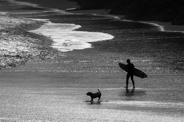
Not us, of course. We didn’t go surfing or fishing at Muriwai beach. We rather walked along the path with our friends watching the surfers and the people fishing on the shore down the cliffs. 

Extreme Rock Fishing
Sports are quite an extreme activity in new Zealand, and this holds true for surfing (the waves are quite strong here, and the cliffs menacing), but even for fishing. It is called “extreme rock fishing” and seems to be very popular at Muriwai beach. The activity consists in fly fishing from rocks battered by the surf. This allows to reach deeper waters (and thus more fish) but entails the risks of being swept away by the waves. Apparently this is the fate of a good number of extreme fishers every year, swallowed by the surf, never to be found again (ok, maybe I am exaggerating, but people do drown this way). We did see some close misses with gigantic waves (the weather was quite stormy as we were there) almost getting some fishers off the flat exposed rocks in the photo on the left. 

When it finally started raining we went back to our friends house (actually to Kendra’s parent house) where we were treated with dinner, and we watched a true kiwi event: a rugby match with the all blacks playing (with the haka and all). The match was against Ireland, and I think they won (we had to leave before the end of the game). I have actually checked on the all blacks official web site and the game was on Jun 7: if true then all dates of this travel diary may be off by one day... oops...

Muriwai Beach, New Zealand (Jun 6, 2008)

Saturday, July 23, 2016

Muriwai Beach

Muriwai Beach, New Zealand (Jun 6, 2008)

Before returning to the US, we made a stop in Auckland, were some friend of us live. Unfortunately, we didn’t have much time to spend there before getting back, but we were able at least to spend a weekend at their place. It was nice, after many years since we last saw each other.

Kendra, Lenya and Greg
We arrived at about dinner time, and we met at the cooperative pre-school where their kids are going (event hough, since we left, the oldest has started primary school). The occasion for meeting there was the celebration of Matariki, the Maori new year, announced by the apparition of the Pleiades in the northern sky. The exact day of the celebration depends on the iwi, but it is in general between June and July. To celebrate, we ate hangi food, cooked to reproduce the traditional Maori way of cooking by hot stones and vapor in a covered pit. The next day we went to Muriwai beach. Despite the very uncertain weather, the place was quite spectacular. The photo above shows weird cliffs with a strange polygonal pattern on top: the little geometrically disposed mounds are gannet nests, now abandoned until the next nesting season. The little photo on the left has our friends Kendra and Greg, with little Lenya carried by her mom (while Tycho and Halen were probably playing on a very vertical sand dune with their grandparents - which are really great people and adopted us while we were there).

Muriwai Beach, New Zealand (Jun 6, 2008)

Sunday, July 17, 2016

Back in Christchurch

Christchurch, New Zealand (May 27, 2008)

This photo (as well as the small one below) is out of order, because the last day spent in the South Island I didn’t shoot a single frame. We arrived in Oamaru late the night before. Our first option was to stop in Dunedin, but we quickly realized that it was too busy a city to easily find an accommodation without reservation. So we continued driving until we reached the smaller town of Oamaru. After checkin-in in a motel we went to search for food. We went back and forth in the Victorian historic district, all built in the famous “Oamaru limestone” without finding anything remotely open. After some searching, and indications from two kids smoking in front of a closed pub, we finally find the bar of a fancy hotel, serving... guess what... our daily fix of fish and chips.

The next day we found the best breakfast place of New Zealand. The Woolstore cafe, located in the restored Woolstore Complex, offers gourmet food in a spacious room with high ceilings. It is the perfect place to sit and read, and the food is really excellent. If you pass through Oamaru it is definitely worth the stop. We found the cafe by chance, on our way to Oamaru’s blue penguins colony touristic center. The center was closed, and in fact there were no penguins on the beach (of course, during the day the penguins are busy fishing). The place, however, looked a little sad, with a huge concrete tribune facing the beach for easy penguin watching. The place is equipped with floodlights to allow seeing the penguins after sunset, when the little birds are resting (trying to?). Difficult to judge, as when we were there the center was closed, but my feeling is that the penguin watch in places like Nugget point, where the humans are hidden in a way the least intrusive on the wildlife, is more rewarding.

After the breakfast we were on the road again, for the last drive on Route 1 to Christchurch. We left the car at the airport and took the airplane for our last New Zealand stop: Auckland.

Nugget Point, New Zealand (Jun 4, 2008)

Saturday, July 9, 2016

The Penguins at Nugget point

Nugget Point, New Zealand (Jun 4, 2008)


We arrived at Nugget Point that was getting dark. The main feature of this rocky headland is the white lighthouse (photos below), which is accessed from the main Catlins “highway” through an unpaved road closely following the coastline. The last part of this road is narrow and steep, in some points impressively so. Our rented Ford Focus seemed capable to negotiate the slope quite well, so we drove to the end (even though I was a little apprehensive at the idea of having to drive back in the dark). 

Nugget Point lighthouse
Just before the last curve we saw a sign about an “observatory” for the local colony of penguins. We stopped the car and walked on a narrow path leading to a wooden hut hanging to the cliffs. From the windows of the hut there was a good view of the beach and the grassy slope below. At first we didn’t see anything. Then, we saw a pair of yellow-eye penguins pruning, on a platform mid-slope. After a little while, we started seeing one, two, many penguins slowly and clumsily walking out of the water. One would expect penguins to be well adept in getting in and out of the water. Well, that’s not the case. These penguins seemed to do a huge effort to get on dry land, as for every two steps they were negotiating with the swell, the next wave would push them back one step. In the end a dozen or so congregated around the few boulders shown in the photo above. The individuals we saw were all adults, as shown by the yellow band circling around their neck (compare to the photo of the juvenile we saw at Akaroa Harbor). After spending the day at sea they were retreating on terra firma to rest for the night.

As we were watching them, it got dark to the point that making photos was getting impossible. We walked to the lighthouse and then back to the car, aware that we needed to drive 230 km more to get to Oamaru, were we intended to spend our last night in the South Island.

Nugget Point, New Zealand (Jun 4, 2008)

Saturday, July 2, 2016

Curio Bay and the Niagara Falls Cafe

Curio Bay, New Zealand (Jun 4, 2008)

The unpaved road ended at Curio Bay, home of a petrified jurassic forest, a Hector's Dolphin pod, and a yellow eyed penguin colony. We didn’t see any of the above. The sea was so rough that I am quite sure the dolphins were resting in some quieter waters and the penguins were getting their fix of fishes far from the crashing waves. What about the forest? Well, the forest is in the photo above... just submerged. It is best visible at low tide, and we clearly didn’t time it right. The view of the bay was however quite spectacular and worth the stop, with some of the most amazing surf I have ever seen (and heard, the thunder of the waves breaking on the rocks is quite deafening). The spray can get very high, as you can see in the photo below, taken from the top of the cliffs. Below the cliffs there is a beach, were occasionally sea lions can be found (nope, we didn’t see them either). The place was in fact completely empty, I imagine because of the low season and the foul sea. The shores of the Catlins are famous for their numerous ship wrecks: with these waves it is not difficult to understand why.

Curio Bay
In the middle of the Catlins there are diminutive falls that somebody with sense of humor called “Niagara Falls”. We didn’t see the falls, nor the town with the same name, but we did stop in the neighborhood. It was already past lunch time and the town of Niagara was the first settlement we had passed in several hours. We stopped at a nice wooden construction along the Niagara-Waikawa road, with a large “Niagara Falls Cafe and Art Gallery” sign in the front. The entrance is through the art gallery, which we didn’t have much time to explore. The cafe proper is in a luminous room facing a large patio which was closed, due to the cold weather. In the large garden, a goat with a stick stuck on her horns (to prevent her to stick her head in the fence, which apparently she had enjoyed one too many times). On the wall there was a newspaper cutout with the story of the cafe. The owner was a nice New Zealand-born lady that until a few years before was a high level manager of some company in Australia. She got sick of the rat-race, came back home, found an old run-down school building in the middle of the Catlins and converted it into a cafe. The location may seem a little isolated (it was the only place we found in hours of driving), but that same isolation, along a road that is traveled by massive amount of tourists in summer, must be a boon for the business. Deserved business that is, as the sandwiches we got were quite good, the cafe was excellent, and the cake topped with ice cream was even better. 

Restored, we left the cafe directed to our last Catlins stop: Nugget point and its penguin colony. But that is a story for the next post.

Curio Bay, New Zealand (Jun 4, 2008)

Sunday, June 12, 2016

The Catlins

The Catlins, New Zealand (Jun 4, 2008)


For the last full day of our trip in the South Island we had on our plate the crossing of the Catlins. This is a region at the southern tip of New Zealand, between Invercagill and Balclutha, with a spectacular coastline and a dense temperate rainforest. The area had been inhabited by the Maori for more than 1,000 years. The modern name of the Catlins, however, is from Captain Edward Cattlin, who bought a large piece of land on 15 February 1840 from Kāi Tahu chief Hone Tuhawaiki for muskets and £30 (roughly NZ$3000 in 2005 dollars). The land commissioner declined to endorse the purchase, and most of the land was then returned to the Maori after Cattling death, but the name stuck.

The Catlins
We left Te Anau early in the morning on Route 94, turning South at Gore to reach the “Catlin Highway”. I am putting quotes here, because this part of the Southern Scenic Route is no longer designated as a the State Highway 92. It is instead a collection of roads of different size, some of them not fully paved, many of them quite scenic. We were in a hurry, so we couldn’t stop much along the way, but the little roads of the Catlins are certainly worth spending some slow time, looking at the local fauna and at the landscape. We took one of these little roads, passing through the costal hills of the Catlins. The photo on the left shows one of the many ponds along the way, with the usual complements of sheep and aquatic birds (this time, uncharacteristically, swans). The photo above was instead farther down the way, I believe along the Haldane-Curio bay road, an unpaved road that leisurely crosses the southern part of the Catlins. The road ended up in Curio bay, but I will leave that for next post.

The Catlins, New Zealand (Jun 4, 2008)

Monday, May 30, 2016

The Moose in Te Anau

Milford Sound, New Zealand (Jun 3, 2008)

In total we spent two nights in Te Anau. The first night we visited the glowworm caves, and the second we recovered the photos almost lost in the "boat accident" at Milford Sound. In both cases we had been late for dinner, and survived on our daily fix of chips and fish at the local pub “The Moose”.


Eglinton Valley
You may ask: why anybody would want to name a pub “The Moose” in the New Zealand South Island? Well, we found the explanation in a journal framed on the pub walls: some people in Te Anau do believe that there are moose in the wild forests of Fiordland. The story goes like this. In 1909 the Canadian government agreed to capture 17 moose calves to be shipped to New Zealand. The 10 calves that survived the trip where then released at Supper Cove, Dusky Sound, in April 1910, with the hope to create a local population of moose to allow future big game hunting. This was the second time Canada actually agreed to give moose to New Zealand. A first attempt in 1900 failed when all the shipped animals, minus one female, died during the trip. The surviving semi-tame cow never left for the forest, frequenting for the next 14 years the streets of the local settlements. The calves of 1910, instead thrived in their new home, to the point that in 1920 hunting licenses were issued. Two animals were killed between 1929 and 1934, but in the subsequent years the moose were forgotten, even though there are records of other animals killed in the 1950s. In 1972 there was a survey attempting to quantify the size of the surviving population, but no animal was found, leading to the conclusion that the moose had gone extinct due to the competition with red deers (another imported species, that had multiplied beyond measure completely destroying the local forest ecosystem).

In 2000 traces of a moose were found by two hunters, and DNA testing of recovered snagged hairs confirmed the moose presence. Despite this, the subject of current moose presence in New Zealand is still controversial (most people don’t believe it), and the naming of the pub after the fables animal looked more like a running joke. Still the fish and chips were good, the fireplace very welcoming after the cold wind in our Milford Sound boat trip. And the local beer was excellent, moose or no moose.

A lake on the way back from Milford Sound, New Zealand (Jun 3, 2008)

Saturday, May 14, 2016

Milford Deep

Milford Sound, New Zealand (Jun 3, 2008)

The fishes in the small photo below are Butterfly Perches, which are one of the many species living in the waters of Milford Sound. The white “branch” in the background is instead the very rare black coral (which is actually white, or bright colored, the black moniker due to the color of its skeleton). Black corals live only at great depths, but in Milford Sound can be found closer to the surface because of the unusual darkness of its waters. The steep walls of the mountains in the fiord are rich in vegetation, but lack soil. As a consequence, the rain washes all organic matters directly in the sound, which is rich of tannin. That makes the water very dark, and allows the growth of the black coral.

Butterfly perches and black coral
The photo was not taken in an aquarium, nor we did scuba diving. We would have liked to (we even brought our masks along, but time (lack of) and a persistent congestion prevented that. Plus the New Zealand seas are quite cold all year round, and we were in winter. We however did see the marine life of Milford Sound in its natural setting. The Milford Discovery Center and Underwater Observatory is a floating cylinder of concrete that is immersed over 10 meters deep in the sound. From its windows 12 cm thick it is possible to see the wildlife as you would see it from the window of a submarine. The observatory (which is built like a floating “tank” and as such doesn’t have any ecological impact on the fragile ecosystem of the sound) is exactly the opposite of an aquarium: the wildlife outside the window is completely free, its the people that are stuck in a “air” tank.

Milford Sound, New Zealand (Jun 3, 2008)


Saturday, April 30, 2016

Disaster!

Milford Sound, New Zealand (Jun 3, 2008)

How many memory cards do you have for your camera while traveling?


...


We went on the boat tour with some friends that were also traveling in New Zealand and happened to be directed to Milford Sound the same day as us (ok, it was not by chance, we exchanged a couple of text messages to make that happen). Despite being very cold, we decided to do the tour on the open deck of the boat, because the sun was so bright that it would have been a shame to stay inside. Besides, I came all the way to New Zealand to take pictures, right?


So we were, the four of us, on the bow of the vessel navigating the placid waters of the sound. The sound (which is quite deep) is protected by the strong currents of the Tasman sea by a shallower entrance, corresponding to the terminal moraine left by the glacier that 10,000 years ago created the fiord. The entrance to the sound is in fact so narrow that captain Cook missed it, when in 1769 he circumnavigated New Zealand during its first voyage. The scenery is so beautiful that I kept shooting non stop from the deck of the boat, and by the time we arrived at the entrance of the sound I had filled my memory card and was time to change it with a new one.


Tasmanian Sea
As I was kneeling to my backpack to get the new card, I half heard the captain saying to hold tight because we were about to enter the Tasman sea, famous for its currents. I guess at that point he advised everybody to get back inside because the sea was going to get rough. Well, as soon as he finished talking, while I was still with the old card in my mouth, the new one in one hand and the camera in the other, a gigantic wave hit the boat. I was launched towards the sky (fortunately I fell back in the boat) while the wave washed the deck through the hole of the anchor, drenching everybody still on the deck. As you can imagine I was a little startled, but seeing some photo opportunities (see photo on the left) I just put the card in the camera, deleted whatever old images were on it, and prepared to shoot again. Well... here is the problem. In the confusion I put back the card I had just filled with all the photos of Route 94 and Milford sound, and then deleted all of them. All 100 photos of the day: gone.

That’s why I asked how many cards do you bring along with you. I usually prefer more smaller cards, so that if anything happens to one of them, I still have the others. Still that can lead to accidents like this one if you are not very careful (or if you are distracted by almost getting thrown overboard). So, there I was, wet, without photos, kind of upset... tempted to launch the damn card overboard once for all... and I would have probably done that if Mayli hadn’t forced me to calm down and hand her over the card for safe-keeping.


When we went back to the Motel, we managed to get internet to see if anything could be done. After a quick search with Google, find out that Lexar (the manufacturer of my cards) sells a program, Image Rescue, capable to recover photos that have been accidentally deleted, as long as they are not overwritten by new ones. Apparently I am not the only bozo deleting photos by mistake. The program really worked well, and I was able to recover 95 of the 100 photos I thought were irrecoverably lost. Definitely $30 well spent. Now I keep a copy of the software on each of my memory cards (in the directory that is not cleared when the photos are deleted)... just in case...

Milford Sound, New Zealand (Jun 3, 2008)

Thursday, April 28, 2016

Milford Sound

Milford Sound, New Zealand (Jun 3, 2008)

We arrived at Milford Sound in time for one of the boat tours. Given the enormous number of tourists that in the high season visit the sound, there are several companies with equally enormous multiple-deck boats offering 1-2 hours tours. This has been criticized by environmental associations, for the impact that the motorized cruise traffic may have on the fragile ecosystem of the sound.

Waterfall in Milford Sound
In the February of 2004 a spill of 13,000 liters of diesel fuel was found in the water. The spill  was apparently intentional, caused by inserting a high pressure hose in the tank of a boat, and forcing the fuel to come out. While there was no appreciable damage to the wildlife, the spill interrupted the touristic activities for two days, while the waters were cleaned. The authorities claimed that this was an act of eco-terrorism to protest the excessive number of tourists in the sound. Given that, we chose for our own tour one of the smallest boats available (still large, but not huge). In the end it wasn’t a particular good choice because the captain of the boat was more interested in showing the “postcard like” views of the sound, than the wildlife (the sound has a resident population of seals, penguins and dolphins, and we saw none). Still better than some of the humongous boats. The sound (which is actually a fiord), is in any case really gorgeous, with the spectacular mountains emerging directly from the sea (among which the iconic Mitre Peak). These mountains fall very steep straight to the water, with a lot of exposed rock and little vegetation, so all rain ad snow water flow directly into the sea in a multitude of spectacular waterfalls, like the “rainbow fall” in the image on the left.

Milford Sound, New Zealand (Jun 3, 2008)

Wednesday, April 13, 2016

The Road to Milford Sound

Eglinton Valley, New Zealand (Jun 3, 2008)

We woke up in the coldest morning since our arrival in New Zealand. As we moved South, and more into the winter, the temperature had been falling, but this was the first time we found the car completely covered by a thick layer of frost. We set up to leave as early as possible because the destination of the day was Milford Sound. Piopiotahi in Maori (after the now extinct piopio bird), it is probably the most famous touristic destination of New Zealand. So famous that, during Summer, its single access road is completely congested with the traffic of 500,000 tourists each year.

Along the Road to Milford Sound
Being Winter, it wasn’t that bad, and in fact we were often the only car on the road. Route 94, the “Te Anau - Milford Highway”, is actually a nice single lane road, that covers the 121 km between Te Anau and the Sound along the Eglinton and Hollyford Rivers to the East and the Cleddau to the West. The road was opened only in 1953, when the 1270 m long Homer Tunnel was completed. The tunnel crosses the highest point in the route, at almost 1000 m of elevation. Not too much in absolute terms, but the mountains on the side of the road are still quite impressive (see photo below). In winter the road is often closed due to avalanches. Before Route 94 was completed, Milford Sound was only accessible from the sea, or by a 4 day hike along the Milford Track. The track has been defined as “The Finest Walk in the World” by New Zealand poet Blanche Baughan, and the name stuck. Due to our lack of training and time, we could not walk along the track, which must be quite a spectacular experience.

Even the road, however, was spectacular, and more so in this cold winter morning, with few cars and a crystal clear sky. The large photo above, one of my favorite of the entire trip, shows the Eglinton Valley: fiery mountains covered with snow, mist slowly dissipating with the first rays of the sun, and the glossy frost covering the dry grass and the naked bushes.


View near the entrance to Homer Tunnel, New Zealand (Jun 3, 2008)

Sunday, April 3, 2016

From Wanaka to Te Anau

Lake Hawea, New Zealand (Jun 2, 2008)

The huge Lake Wanaka is separated from the slightly smaller Lake Hawea by less than 1 km of land. Both lakes fill glacial valleys left behind by glaciers that retired 10,000 years ago, and are now renowned touristic destinations. The photo above is of Lake Hawea.

Geomagnetic cows
I mentioned in the previous post the abundance of farm animals we encountered during our detour in the Treble Cone sky valley. Sheep, yes, but also cows resting leisurely in the early winter sun. If you look closely at the photo on the left, you will see that all cows appear to be aligned. The alignment seems to be the same of the shadow of the trees that, given that the photo was taken at about midday, was oriented roughly North-South. This seems to confirm a research, made by Dr. Sabine Begall and colleagues from the University of Duisburg-Essen, that resting cows (and deer) appear to be preferentially aligned with the magnetic compass. The research was made using Google Earth images of cows in Britain, Ireland, India and the USA, but apparently the same phenomenon is true for the upside-down New Zealand cows. I wonder if it works for sheep too.

Mayli freezing
From Wanaka we went back on our way to Queenstown. Rather than taking the main road (the fast Route 6 following the Clutha River), we cut trough the scenic Cardrona Valley road, set in the Crown Range mountains. While Cardrona is now just a dot in the map, during the Central Otago Gold Rush of the 1860s was a booming town with a population of several thousand prospectors, with the fascinating history of frontier towns, including the now almost-forgotten contribution of thousands of Chinese workers. The road climbs the Crown Range up to a pass overlooking the valley of Queenstown. We stopped at the pass, and attempted to take some shots at the city in the distance, with little success given that it was freezing cold (see photo on the right), windy and briefly snowing. While we were at the pass, however, we saw a large airplane (a jet) flying very low in the valley. It was a pretty scary view, as we could see the airplane from above, and it was not very clear if there were any places suitable for it to land. Well, it turned out that the plane was directed to the airport of Queenstown, eerily hidden between the mountains on the shores of Lake Wakatipu. I am sure that landing in Queenstown must be quite an interesting experience (maybe like landing in Merida, Venezuela).


We didn’t stop in Queenstown, as it was getting late and the city looked too much a tourist trap for our tastes. We drove directly to Te Anau, where we arrived just in time to find a suitable Motel, and to get a tour of the glowworm cavesGlowworms [beautiful 4K time lapse here] are the larval stage of flies that lure their prey in the total darkness of their cave using bioluminescence. Their tail emits a bright blue light that is an irresistible attraction to other insets that end up imprisoned into the sticky filaments deployed by the larvae, and then devoured alive. The whole process, if seen in full light, is probably disgusting, but the caves are explored in darkness and what the visitors see is a firmament of luminous spots covering the cave walls, as if the stars had been imprisoned under the mountains.

Central Otago, New Zealand (Jun 2, 2008)